


Earth Map Satellite Live View
3.7189.00 Reviews
App Specs
- Version
- 1.1.0.58
- Updated On
- License
- Free
- Downloads
- 5,000,000+
- Developer
- Synlox Studio
- Categories
- Maps & Navigation
- Platform
- Android, iOS
Screenshots
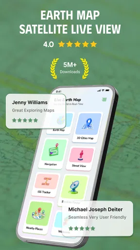
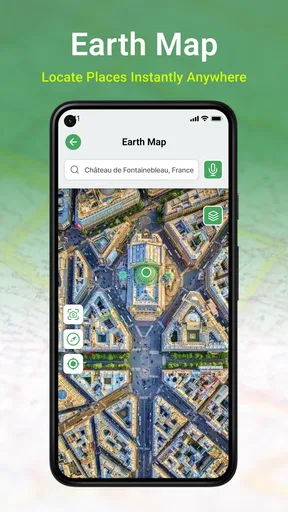
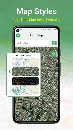
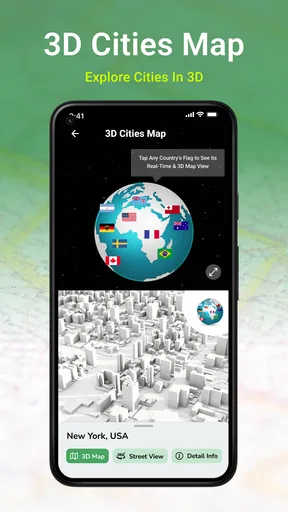
 Analysis by AppCompare
Earth Map Satellite Live View is the kind of navigation app I open when I want to understand a place rather than simply reach it. Its main appeal is the satellite-based view: instead of seeing only roads, labels, and turn instructions, I can look at the actual shape of the area around a destination. That makes it useful for checking coastlines, open land, trails, building layouts, and other visual details that a conventional map can flatten into a few lines.
Developed by Synlox Studio, this free Maps & Navigation app combines a virtual view of Earth with GPS navigation. I found the idea more practical than the store name initially suggests. It is not just something to browse when I am bored. Used carefully, the satellite perspective can help me decide which entrance to use, recognize a destination before arriving, or understand why a normal route looks confusing.
The app has a 3.7 average from around 5.7 thousand ratings and has passed 5 million installs. Those figures suggest a broad audience, but they also set a realistic expectation: this is a popular visual navigation tool, not necessarily a complete replacement for every dedicated mapping service. My experience is strongest when I treat its satellite view as the central feature and use the navigation side for orientation rather than assuming it will cover every specialist need.
Why the satellite view matters more than another ordinary map
Most navigation apps are excellent at reducing a journey to a line between two points. That is convenient, but it can hide the physical character of the destination. A satellite view answers a different question: what does this place actually look like from above? That distinction is the reason I would recommend Earth Map Satellite Live View to someone who regularly visits unfamiliar outdoor locations or struggles to identify a destination from road labels alone.
For example, a standard map may show a large property with one road running past it. A satellite image can reveal the parking area, the building position, nearby open ground, and the likely side from which the property is easiest to approach. It may also show that a seemingly direct path is separated by a river, a wall, dense vegetation, or a wide area without a clear entrance. The useful insight is not simply seeing more detail; it is seeing the physical obstacles that a symbolic map can conceal.
I also like the way this changes pre-trip planning. Before leaving, I can inspect the surroundings and form a visual memory of the destination. That is often more helpful than memorizing a street name. When I later arrive, I am looking for a recognizable arrangement of roads and buildings rather than trying to interpret a screen full of similar labels.
This makes the app especially interesting for travelers, hikers, photographers, students, and anyone exploring a new neighborhood. It can also be handy for checking a meeting point where several entrances exist. The satellite layer gives context that ordinary turn-by-turn navigation usually treats as irrelevant.
Worth Reading Before You Choose

EA SPORTS FC Mobile 26 Is a Bigger Football Game, but It Takes Time

Flipboard Shows What News Apps Must Do Beyond the Feed

Switching to Android Auto Means Rethinking Your Driving Routine

Google Calendar Makes a Crowded Week Easier to Manage

Ludo King Makes the Most of the Minutes Between Plans

Baby Panda World Brings Quick Play to Modern Phones, but Its Game Library Feels Busy
Using the map as a visual briefing
My preferred workflow is to use the app before starting the journey, not only after I am already moving. I search for the destination, switch attention to the satellite imagery, and look outward from the exact point. I check the nearest larger road, the shape of nearby buildings, and any visible open spaces. Then I return to the route and keep those visual landmarks in mind.
This is a small habit, but it helps when the final approach is awkward. A destination pin can be technically correct while still leaving me unsure whether I should stop at the front entrance, continue around the block, or use a side road. Satellite imagery cannot guarantee that every entrance is usable today, yet it gives me a much better starting picture than a bare pin.
Another useful technique is comparing the map view with what I expect to see at ground level. If the satellite view shows a long building beside a distinctive bend in the road, I can use that combination as a confirmation point. I would not rely on a single visual clue, especially in an area that may have changed, but two or three nearby shapes can make arrival less stressful.
For outdoor planning, I use the imagery to judge the general character of a location rather than to promise exact trail conditions. Open areas, wooded sections, shorelines, and clusters of buildings can be easy to recognize from above. However, a satellite image should not be treated as a live safety report. It does not replace current signs, local restrictions, weather information, or common sense on the ground.
What happens during everyday navigation
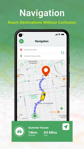
In a normal trip, I find the app most comfortable when I prepare the destination first and then use GPS guidance to maintain direction. The combination is useful because the route tells me where to go while the visual layer helps me understand the surroundings. If I am approaching a large complex, for instance, I can use the road guidance and the previously viewed layout to decide which side of the property makes sense.
A realistic example would be visiting a rural event venue for the first time. A conventional map may guide me along the main road and announce that I have arrived near the destination. Earth Map Satellite Live View can help me see whether the venue sits behind a cluster of buildings, beside a broad field, or down a smaller access road. I would still follow posted signs and avoid making a turn solely because the aerial image appears to show a path, but the extra context reduces guesswork.
In a city, the benefit is slightly different. Satellite imagery can help me recognize courtyards, large blocks, parking areas, and the position of a building within a lot. This is useful when a street address points to a complex with several entrances. It is less useful when I only need the fastest public-transport connection or highly detailed lane guidance, where a specialist navigation service may be clearer.
The app is free to install, and its content rating is Everyone, so it is approachable for families and casual users. The current version is 1.1.0.58, with a minimum operating-system requirement of version 10. I would check that requirement before planning to use it on an older phone, particularly if the device is kept for travel because it may not meet the supported system level.
Where it is stronger than ordinary alternatives
Compared with a basic road map, this app gives me a more intuitive sense of place. Compared with a dedicated GPS navigator, its advantage is not necessarily more sophisticated routing; it is the visual relationship between the route and the land around it. Compared with a globe or satellite browser used only for exploration, it adds a practical navigation purpose.
That middle position is important. If I need traffic-aware commuting, transit departures, business information, or a carefully optimized route, I would choose an established all-purpose navigation service first. If I want to inspect an unfamiliar area from above and then use GPS to orient myself, Earth Map Satellite Live View makes more sense. It earns its place through the combination rather than by being the best tool at every navigation task.
I also appreciate that the satellite perspective can change how I assess distance. Two points may look close on a flat road map, yet the imagery may reveal a barrier or an indirect entrance. Conversely, a destination that appears complicated because of many roads may become simple once I see the actual building and open space arrangement. That kind of visual correction is difficult to get from written directions alone.
Important limits before relying on it
The biggest limitation is that aerial imagery is not the same as a live camera feed. The word “live” can create an expectation of constantly updated ground conditions, but I would use the view as a reference image, not as proof that a road, path, parking area, or building entrance is currently open. Construction, temporary closures, new fences, and seasonal changes can all make an image less reliable.
GPS accuracy can also vary with the environment. Tall buildings, dense trees, and poor visibility of the sky may make the position less stable. When the marker seems uncertain, I slow down and compare the route with visible landmarks instead of making a sudden turn. This is a general navigation habit, but it matters more when the app’s main attraction encourages close inspection of the map.
I would also avoid using the app as my only tool for serious outdoor navigation. Satellite imagery can show terrain patterns and broad land use, but it does not automatically tell me whether a route is legal, safe, maintained, or suitable for my ability. For hiking or remote travel, I would pair it with current local information and a dependable backup method.
There is another practical trade-off: the more I focus on imagery, the easier it is to become distracted by visual detail. I prefer checking the satellite view while stopped, before driving or walking through a busy area. During movement, I keep my attention on safe travel and use the navigation guidance only as a supporting aid.
Costs, version, and the free experience
The app is free, but it includes optional in-app purchases ranging from $4.49 to $14.99 per item. That means I can try the core experience without paying upfront, while some users may encounter paid extras depending on how they use the app. I would begin with the free version and decide whether the additional options genuinely improve my own trips before spending anything.
This pricing model is reasonable for someone who wants to test the satellite-navigation concept without committing immediately. It is less attractive to a user who expects every advanced convenience to be included at no cost. Since navigation is personal, the right decision depends on whether the app becomes part of a regular planning routine or remains an occasional visual reference.
The version number and operating-system requirement are also worth keeping in mind when installing on a travel phone. I would update the app before a major trip rather than waiting until I need it at a destination. More importantly, I would test the search and GPS behavior near home first, where I can learn the interface without the pressure of being lost somewhere unfamiliar.
Who gets the most value from the app
I think the strongest audience is people who navigate by landmarks and surroundings. If you often say, “I will know it when I see it,” the satellite view may suit you better than a map made almost entirely of lines and labels. Travelers visiting large properties, people checking remote destinations, and users who want to understand a neighborhood before walking through it can all benefit.
It is also a good companion for trip planning. I can use it to compare possible meeting points, inspect the setting around a rental or attraction, and prepare a visual route for someone who is unfamiliar with the area. The app is particularly useful when the final destination is more complicated than its address suggests.
On the other hand, I would skip it as a primary navigation choice if my priority is public transportation, live traffic decisions, detailed business discovery, or highly specialized topographic guidance. In those situations, another category-focused tool will usually answer the important question faster. Earth Map Satellite Live View is most convincing when the question is, “What does this place look like from above, and how can that help me orient myself?”
My practical recommendation
I recommend installing it for the satellite perspective, not simply because it is another GPS app. Start by choosing a familiar location and comparing its ordinary map position with the aerial view. Then try the pre-trip workflow: inspect the destination, identify two visual landmarks, and use the route while checking whether the real surroundings match what you saw.
That approach reveals its real strength quickly. The app does not eliminate the need for judgment, and I would not treat its imagery as a guarantee of current access. But it can turn an abstract route into a recognizable place, which is a meaningful advantage when the destination is unfamiliar or visually confusing.
After using it, my view is that Synlox Studio has built a useful niche tool for satellite map exploration and GPS orientation. It is free to try, accessible to a general audience, and supported by a substantial installed user base. I would keep a conventional navigation app available for traffic, transit, and detailed route decisions, but I would choose Earth Map Satellite Live View whenever seeing the land itself is more valuable than seeing another set of directions.
Pros
- Clear satellite imagery helps identify terrain
- roads
- and landmarks.
- Simple map controls make zooming and panning easy for most users.
- Useful for exploring unfamiliar areas before trips or outdoor activities.
- Location search can quickly center the map on a chosen place.
- Works as a visual complement to standard street-map applications.
Cons
- Image quality and update dates vary significantly by location.
- Some advanced viewing features may require in-app purchases.
- Satellite imagery can use substantial mobile data during extended browsing.
- Live traffic or real-time environmental changes are not guaranteed.
- Ads may interrupt navigation or reduce the overall viewing experience.
FAQs for Earth Map Satellite Live View
What is Earth Map Satellite Live View?
Earth Map Satellite Live View is a mapping and satellite-imagery application designed to let users explore locations from an overhead perspective. It can be useful for viewing terrain, landmarks, roads, coastlines, and geographic areas that are difficult to inspect in person. Before downloading, users should understand that the app is primarily an exploration and map-viewing tool, not a replacement for professional navigation, surveying, or real-time satellite monitoring services.
Does Earth Map Satellite Live View show real-time satellite images?
Despite the word “Live” in its name, satellite imagery in apps of this type is generally not continuously updated in real time. Images may come from map or satellite-data providers and can vary in age depending on the location. Some areas may display relatively recent imagery, while others may show older photographs. For emergencies, construction decisions, property verification, or precise planning, users should confirm information with official and up-to-date sources.
Can I use Earth Map Satellite Live View without an internet connection?
The main satellite maps and location data normally require an internet connection because the application loads imagery from online servers. Performance may depend on connection speed, signal strength, and the amount of map detail being displayed. If you plan to use the app while traveling, check whether it provides any offline-map or saved-location features. Even when some content is cached, full satellite exploration may not work reliably without mobile data or Wi-Fi.
Is Earth Map Satellite Live View accurate enough for navigation or measuring land?
The app can be helpful for general visual reference, route planning, and exploring geographical areas, but satellite imagery should not be treated as a legally accurate survey. Image alignment, update dates, zoom quality, and map labels can differ between locations. Measurements or boundaries shown in the app may be approximate. For land ownership, engineering, construction, or legal purposes, users should rely on certified maps, surveyors, government records, or professional geographic-information tools.
Are there privacy or safety concerns when using Earth Map Satellite Live View?
Before installing, review the permissions requested by the application and its privacy policy. A map app may request access to location services, which can improve positioning but may also involve collecting location-related information. Avoid assuming that imagery is private or current, and do not use the app to make sensitive decisions about people or properties. Downloading from the official Google Play Store or Apple App Store also helps reduce the risk of modified or unsafe copies.


